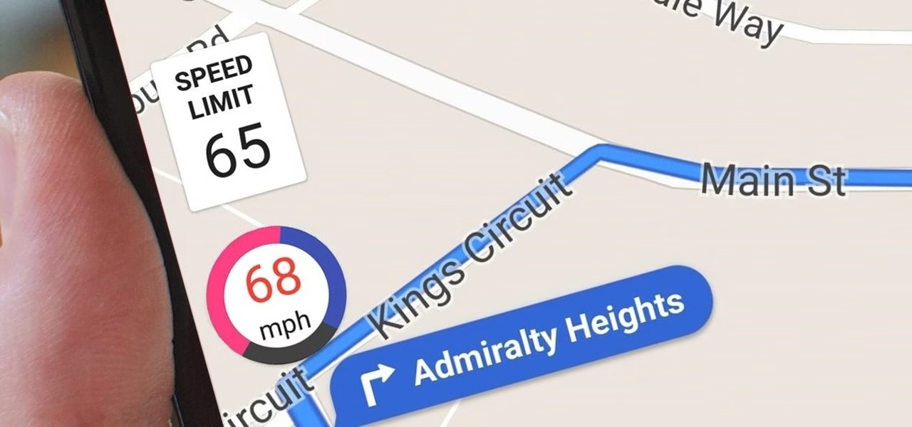
Google Maps Speedometer: How Accurate Is It Really?
Ever glanced at your phone's speed display in Google Maps and wondered how it stacks up against your car's speedometer? It's a question many drivers ponder, especially with the increasing reliance on our smartphones for navigation. While the convenience is undeniable, the accuracy of Google Maps' built-in speedometer is a topic that sparks a fair bit of curiosity. Let's dive deep into what makes it tick, its recent improvements, and how it performs in the real world.
The Tech Behind the Speed Reading
At its core, Google Maps' speedometer isn't some fancy, independent gadget. It's a clever integration of your smartphone's existing hardware: the GPS receiver and the accelerometer. When you're actively navigating, the app taps into these sensors to calculate your speed, displaying it right there on your screen, usually in miles per hour (mph) or kilometers per hour (km/h). You might also notice those handy color-coded speed limit warnings – green for good, red for a little too fast.
This is a far cry from how your car's speedometer works. Your car typically relies on the rotation of its wheels or internal vehicle sensors to gauge speed. Google Maps, on the other hand, is all about satellite signals. In theory, with a clear view of the sky and strong satellite reception, it's designed to be pretty darn precise, within a few percentage points. But, as anyone who's driven through a dense city or a tunnel knows, real-world conditions can throw a wrench in even the best-laid plans.
Urban Canyons and Signal Struggles
One of the biggest hurdles for GPS accuracy is the "urban canyon" effect. Those towering skyscrapers in downtown areas can bounce satellite signals around, making it difficult for your phone to get a clean fix on its location. This multipath interference can lead to noticeable discrepancies in speed readings. Similarly, driving through tunnels or areas with heavy tree cover can temporarily cut off or weaken the GPS signal, causing the displayed speed to lag or become temporarily unavailable. It's a constant battle between the digital world and the physical environment.
Google's 2025 Enhancements: Smarter, Faster, More Accurate?
Google hasn't been sitting still. In recent times, there's been a significant push to beef up the accuracy and reliability of its mapping features, including the speedometer. The big buzzword here is AI. By leveraging advanced machine learning algorithms and drawing on data from millions of users, Google is refining how it calculates speed.
AI-Powered Precision and Speed Limit Smarts
Recent updates, particularly those rolled out in mid-2025, have introduced AI-driven refinements designed to better account for common GPS drift. This is especially helpful in those tricky urban environments, potentially improving accuracy by a decent margin. Furthermore, Google has been working on smarter speed limit detection. By cross-referencing GPS data with official road authority information and user-submitted reports, the app aims to provide more accurate speed limit displays and reduce those annoying false alerts. It's all about making the feature more trustworthy for everyday use.
These aren't just minor tweaks; they represent a broader strategy to make Google Maps a more robust and intelligent navigation tool. While they don't offer a hard guarantee on pinpoint accuracy, the commitment to continuous improvement through over-the-air updates is a positive sign for users.
Real-World Performance: What Do the Numbers Say?
So, after all the tech talk and updates, how does the Google Maps speedometer actually perform? Independent tests and user feedback offer a pretty good picture. On open highways, with good conditions, it's generally quite accurate, often within a few miles per hour of your car's speedometer. You're likely to find it matches your car's reading about 90% of the time in these scenarios.
Comparing Apples and Oranges: Car vs. App
It's important to remember that your car's speedometer and Google Maps' speedometer are measuring speed differently. Your car's gauge is intrinsically linked to your vehicle's mechanics, while Google Maps relies on external satellite signals. This fundamental difference means they won't always be in perfect lockstep. Think of it like comparing a thermometer that measures the air temperature directly in a room versus one that estimates it based on how warm the wall feels – they're both trying to tell you the temperature, but their methods differ.
User Experiences and Expert Takes
The chatter on forums and social media reflects this mixed but improving reality. While some users still report occasional frustrations with speed limit inaccuracies, particularly in less common road layouts, many appreciate the feature's presence. For some, it's been a lifesaver, helping them avoid tickets during busy commutes.
Experts generally agree that while Google Maps might not always be the absolute gold standard for hyper-local, real-time speed accuracy compared to some dedicated navigation apps that rely heavily on crowd-sourcing, its recent updates have made it a solid and reliable tool for everyday driving. The improvements are noticeable, and for the average commuter, it's more than sufficient.
The Bottom Line: Is It Reliable Enough?
So, should you ditch your car's speedometer and rely solely on Google Maps? Probably not entirely. But should you trust it as a helpful guide? Absolutely. The Google Maps speedometer has evolved significantly, becoming a more accurate and useful feature than ever before. Its conservative nature might even offer a slight buffer against unintentional speeding.
Ultimately, it's a fantastic supplementary tool. It provides a quick, visual cue to your speed and helps you stay aware of posted limits, contributing to safer driving habits. And with Google's continued investment in AI and data refinement, we can expect it to get even better. It's a testament to how far smartphone technology has come, putting useful, data-driven features right into our pockets.
